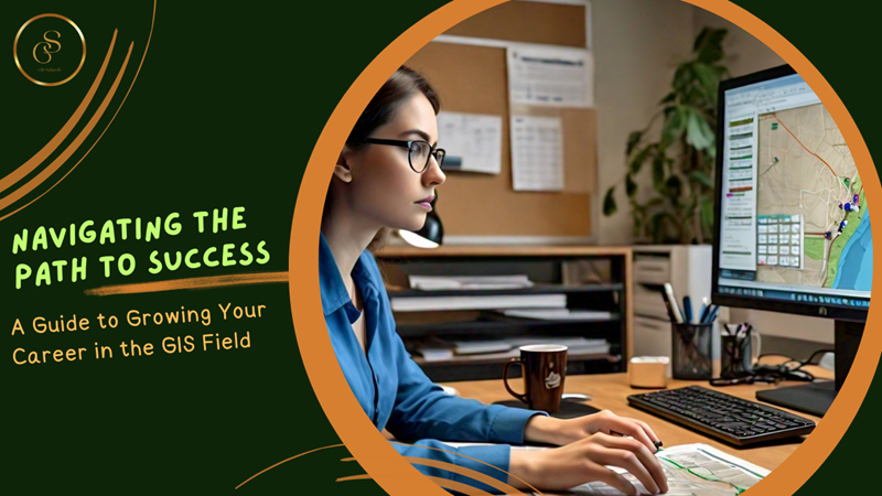
The Geographic Information System (GIS) field has experienced rapid growth in recent years, with applications in various industries such as urban planning, environmental management, and emergency response. If you're looking to start or advance your career in GIS, it's essential to know the best track to follow. In this article, we'll explore the steps to take for professional growth and success in the GIS field.
Step 1: Build a Strong Foundation in GIS Fundamentals
Building a strong foundation in GIS fundamentals is crucial for a successful career in the Geographic Information System field. This step is essential for understanding the basics of GIS and developing a solid grasp of its concepts, techniques, and software applications. Here's a detailed guide on how to build a strong foundation in GIS fundamentals:
- Learning the Basics of GIS
Start by understanding the core concepts of GIS, including:
- Data Structures: Learn about the different data structures used in GIS, such as vectors (points, lines, and polygons), rasters (grids), and 3D data.
- Spatial Analysis: Understand the fundamental principles of spatial analysis, including spatial relationships, spatial autocorrelation, and spatial interpolation.
- Mapping Techniques: Familiarize yourself with various mapping techniques, such as cartographic projections, symbolization, and visualization.
- Familiarizing Yourself with Popular GIS Software
Get hands-on experience with popular GIS software applications, including:
- ArcGIS: Developed by Esri, ArcGIS is a comprehensive GIS software suite that offers a wide range of tools and functionalities.
- QGIS: An open-source GIS software that offers many of the same functionalities as ArcGIS, but with a free and flexible license.
- Google Earth: A popular geospatial platform for visualizing and exploring spatial data in a 3D environment.
- Online Courses and Workshops
Take online courses or attend workshops to gain hands-on experience and deepen your understanding of GIS fundamentals. Some popular resources include:
- Esri Academy: Offers a wide range of online courses and certifications in GIS and spatial analysis.
- QGIS Tutorials: Provides step-by-step tutorials and exercises for learning QGIS.
- Coursera: Offers online courses on GIS and spatial analysis from top universities and institutions.
- Udemy: Provides a wide range of online courses and tutorials on GIS and spatial analysis.
- GIS Workshops: Attend workshops and conferences organized by GIS communities, universities, and organizations to network with professionals and learn from experts.
- Key Skills to Focus On
When building your foundation in GIS fundamentals, focus on developing the following key skills:
- Data management: Learn to create, edit, and manage spatial data.
- Spatial analysis: Understand how to perform spatial joins, buffers, and other spatial operations.
- Mapping and visualization: Develop skills in creating effective maps and visualizations.
- Programming: Familiarize yourself with programming languages like Python, R, or SQL to automate GIS tasks and build custom applications.
Building a strong foundation in GIS fundamentals is essential for a successful career in the GIS field. By learning the basics of GIS, familiarizing yourself with popular GIS software, and taking online courses or attending workshops, you'll develop a solid understanding of GIS concepts, techniques, and software applications. This will prepare you for more advanced topics and specializations in the GIS field.
Step 2: Develop Your Technical Skills
Learning programming languages is essential for automating GIS tasks, building custom applications, and integrating GIS with other technologies. Here's a detailed overview of the programming languages and their applications in GIS:
- Python:
- Popular libraries like Geopandas, Fiona, and Shapely provide efficient data manipulation and analysis.
- ArcPy and QGIS Python API allow for scripting and automation of GIS tasks.
- Python's simplicity and flexibility make it an ideal language for GIS development.
- R:
- R's spatial packages like sp, rgdal, and geosphere provide advanced spatial analysis capabilities.
- R's data visualization libraries like ggplot2 and leaflet enable interactive and dynamic mapping.
- R's statistical capabilities make it ideal for spatial modeling and analysis.
- SQL:
- SQL is essential for managing and querying large spatial databases.
- Spatial databases like PostGIS and Oracle Spatial enable efficient storage and querying of spatial data.
- SQL skills are crucial for integrating GIS with other data systems.
Data Visualization Tools for Effective Communication
Data visualization is critical for communicating spatial data insights effectively. Here's a detailed overview of popular data visualization tools:
- Tableau:
- Tableau offers interactive and dynamic mapping capabilities.
- Its user-friendly interface makes it easy to connect to various data sources.
- Tableau's data visualization capabilities make it ideal for presenting spatial data insights.
- Power BI:
- Power BI offers advanced data visualization capabilities, including 3D mapping.
- Its integration with Microsoft products makes it ideal for enterprise environments.
- Power BI's interactive dashboards enable effective communication of spatial data insights.
- D3.js:
- D3.js is a powerful JavaScript library for web-based data visualization.
- Its flexibility and customization capabilities make it ideal for complex spatial data visualization.
- D3.js is widely used in web applications and dashboards.
Emerging Technologies for Staying Up-to-Date
Staying up-to-date with emerging technologies is crucial for GIS professionals. Here's a detailed overview of emerging technologies and their applications in GIS:
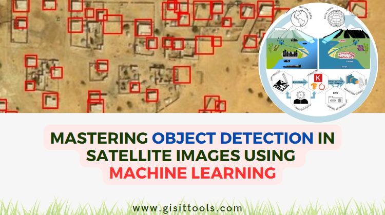
- Machine Learning:
- Machine learning algorithms like deep learning and neural networks can be applied to spatial data for predictive modeling and pattern recognition.
- Libraries like scikit-learn and TensorFlow provide efficient implementation of machine learning algorithms.
- Cloud Computing:
- Cloud platforms like Amazon Web Services (AWS) and Microsoft Azure offer scalable and on-demand computing resources.
- Cloud-based GIS services like ArcGIS Online and Google Earth Engine enable collaborative and web-based GIS applications.
- Internet of Things (IoT):
- IoT sensors and devices generate vast amounts of spatial data, which can be integrated with GIS for real-time monitoring and analysis.
- IoT applications like smart cities and precision agriculture rely heavily on GIS and spatial analysis.
By learning programming languages, exploring data visualization tools, and staying up-to-date with emerging technologies, GIS professionals can develop a competitive edge in the industry and stay ahead of the curve.
Step 3: Specialize in a Domain
Specializing in a domain is a crucial step in advancing your career in the GIS field. By focusing on a specific industry or application area, you can develop a deeper understanding of the unique challenges and opportunities within that domain. Here's a detailed discussion of the domains mentioned earlier:
1. Urban Planning and Transportation
- Tools: ArcGIS, QGIS, UrbanSim, TransCAD
- Methods: Spatial analysis, network analysis, land use planning, transportation modeling
- Best Practices: Integrating GIS with urban planning and transportation systems, using spatial data to inform policy decisions
- Applications: Urban planning, transportation planning, land use management, smart cities
2. Environmental Monitoring and Conservation
- Tools: ArcGIS, QGIS, ENVI, ERDAS
- Methods: Remote sensing, spatial analysis, habitat modeling, environmental monitoring
- Best Practices: Using GIS to monitor and manage natural resources, integrating GIS with environmental modeling and simulation
- Applications: Environmental monitoring, conservation, natural resource management, climate change research
3. Emergency Response and Disaster Management
- Tools: ArcGIS, QGIS, Emergency Response System (ERS), DisasterAWARE
- Methods: Spatial analysis, emergency response planning, damage assessment, resource allocation
- Best Practices: Using GIS to respond to emergencies, integrating GIS with emergency response systems
- Applications: Emergency response, disaster management, humanitarian assistance, crisis mapping
4. Geospatial Intelligence and National Security
- Tools: ArcGIS, QGIS, Geospatial Intelligence (GEOINT) software, National Geospatial-Intelligence Agency (NGA) tools
- Methods: Spatial analysis, geospatial intelligence, surveillance, reconnaissance
- Best Practices: Using GIS to support national security, integrating GIS with intelligence systems
- Applications: Geospatial intelligence, national security, defense, homeland security
Benefits of Specializing in a Domain
- Deeper Understanding: Specializing in a domain allows you to develop a deeper understanding of the unique challenges and opportunities within that domain.
- Expertise: You can develop expertise in the relevant tools, methods, and best practices, making you a valuable asset to organizations.
- Career Advancement: Specializing in a domain can lead to career advancement opportunities, as organizations seek professionals with expertise in specific areas.
- Networking: You can connect with professionals in your domain, building a network of contacts and potential collaborators.
Specializing in a domain is essential for advancing your career in the GIS field. By focusing on a specific industry or application area, you can develop expertise in the relevant tools, methods, and best practices, leading to career advancement opportunities and a deeper understanding of the unique challenges and opportunities within that domain.
Step 4: Join Professional Networks and Communities
Joining professional networks and communities is a vital step in advancing your career in the GIS field. By connecting with GIS professionals and staying informed about industry trends and job opportunities, you can:
Benefits of Joining Professional Networks and Communities
- Networking: Connect with experienced GIS professionals, potential employers, and collaborators.
- Staying Informed: Stay up-to-date with the latest industry trends, technologies, and best practices.
- Career Opportunities: Learn about job openings, internships, and volunteer opportunities.
- Professional Development: Access training, workshops, and conferences to enhance your skills.
- Collaboration: Find potential collaborators for projects and research.
Organizations to Join:
- Urban and Regional Information Systems Association (URISA): A leading organization for GIS professionals, offering conferences, training, and networking opportunities.
- International Association of Geodesy (IAG): A global organization promoting geodesy and GIS, with a focus on scientific research and collaboration.
- Geospatial Information & Technology Association (GITA): A professional association for GIS and geospatial professionals, offering training, conferences, and networking.
- American Society for Photogrammetry and Remote Sensing (ASPRS): A professional organization for photogrammetry and remote sensing, with a focus on geospatial technology.
Online Forums and Social Media Groups:
- GeoNet: A community forum for GIS professionals, with discussions on various topics and job postings.
- GIS Stack Exchange: A Q&A forum for GIS professionals, with answers from experienced experts.
- LinkedIn Groups: Join groups like GIS Professionals, Geospatial Professionals, or Spatial Analysis and Mapping.
- Twitter: Follow GIS professionals, organizations, and hashtags like #GIS, #geospatial, or #mapping.
Local Meetups:
- GIS User Groups: Attend local meetups and conferences organized by GIS user groups.
- Professional Association Meetings: Attend meetings and events organized by local chapters of professional associations.
- Hackathons and Challenges: Participate in hackathons and challenges focused on GIS and geospatial technology.
Joining professional networks and communities is essential for advancing your career in the GIS field. By connecting with GIS professionals, staying informed about industry trends and job opportunities, and accessing training and collaboration opportunities, you can enhance your skills, build your network, and stay ahead in the industry.
Step 5: Pursue Certifications and Higher Education
Obtaining certifications is an excellent way to demonstrate your expertise and commitment to the GIS field. Two notable certifications are:
- Certified GIS Professional (CGP): Offered by the GIS Certification Institute (GISCI), this certification recognizes professionals who have met the standards for GIS knowledge, skills, and experience.
- Esri Certified ArcGIS Desktop Associate: Offered by Esri, this certification validates your skills in using ArcGIS Desktop for spatial analysis, mapping, and data management.
Benefits of Certifications:
- Demonstrated Expertise: Certifications showcase your knowledge and skills to potential employers and clients.
- Career Advancement: Certifications can lead to career advancement opportunities and higher salary potential.
- Networking: Certification holders can connect with other professionals through certification organizations.
- Staying Current: Certifications require ongoing education and professional development, ensuring you stay up-to-date with industry advancements.
Master's Degree in GIS or a Related Field:
Pursuing a master's degree in GIS or a related field, such as geography, urban planning, or environmental science, can significantly advance your career and increase earning potential.
Benefits of a Master's Degree:
- Advanced Knowledge: A master's degree provides advanced knowledge in GIS, spatial analysis, and related fields.
- Specialization: You can specialize in a specific area, such as remote sensing, geospatial intelligence, or spatial modeling.
- Research and Development: A master's degree prepares you for research and development roles, enabling you to contribute to innovative projects and publications.
- Leadership and Management: A master's degree can lead to leadership and management roles, overseeing GIS projects and teams.
- Higher Earning Potential: A master's degree can significantly increase your earning potential, with median salaries ranging from $70,000 to over $100,000.
Certifications and a master's degree in GIS or a related field can significantly enhance your career prospects and earning potential. By demonstrating your expertise, staying current with industry advancements, and advancing your knowledge and skills, you can excel in the GIS field and pursue leadership and management roles or specialized positions in research and development.
Step 6: Stay Current and Continuously Learn
The GIS field is constantly evolving, with new technologies, methodologies, and applications emerging regularly. To stay ahead in the field, it's essential to commit to ongoing learning and professional development. Here's a detailed discussion of how to stay current and continuously learn:
Attend Conferences, Webinars, and Workshops:
- Conferences: Attend national and international conferences, such as the Esri User Conference, URISA, and IAG, to learn from industry experts and network with peers.
- Webinars: Participate in webinars hosted by organizations like Esri, URISA, and GITA to stay updated on specific topics and technologies.
- Workshops: Attend hands-on workshops and training sessions to learn new skills and gain practical experience.
Benefits of Attending Conferences, Webinars, and Workshops:
- Networking: Connect with industry professionals, potential employers, and collaborators.
- Knowledge Sharing: Learn from experts and share your own experiences and knowledge.
- Staying Current: Stay updated on the latest technologies, methodologies, and applications.
- Professional Development: Enhance your skills and knowledge to advance your career.
Read Industry Publications, Blogs, and Books:
- Industry Publications: Subscribe to publications like ArcUser, GeoWorld, and GIS Magazine to stay informed about industry trends and advancements.
- Blogs: Follow industry blogs, such as GeoAwesomeness, GIS Lounge, and Spatially Challenged, to stay updated on the latest news and developments.
- Books: Read books on GIS, spatial analysis, and related fields to expand your knowledge and understanding.
Benefits of Reading Industry Publications, Blogs, and Books:
- Knowledge Expansion: Gain a deeper understanding of GIS concepts, technologies, and applications.
- Staying Informed: Stay up-to-date on industry trends, news, and developments.
- Networking: Connect with authors, bloggers, and industry experts through social media and online communities.
- Professional Development: Enhance your skills and knowledge to advance your career.
Staying current and continuously learning is essential in the GIS field. By attending conferences, webinars, and workshops, and reading industry publications, blogs, and books, you can stay updated on the latest technologies and methodologies, expand your knowledge and network, and advance your career. Remember, lifelong learning is key to success in the GIS field.
Growing your career in the GIS field requires a combination of technical skills, domain expertise, and professional networking. By following these steps, you'll be well on your way to success and making a meaningful impact in this exciting and rapidly evolving field.
Powered by Froala Editor
comments
Leave a Reply
Your email address will not be published. Required fields are marked *